F.A.C.T. - Trail description
1st Day Rangerstation Verkhne-Angarsky Zakaznik

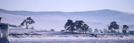
After the ship has found the narrow access to the mooring and the luggage has been unloaded, you should take time to discover and enjoy the beautiful surroundings: The colourful timber houses of the ranger station of the protected area "Upper Angara" (Verkhne Angara Sakaznik), which are surrounded by lush meadows, fit perfectly into the scenery of the up to 2800 metre-high peaks of the snowclad Barguzin mountains.
Due to the beauty of the spot it is worth not setting off before the following day, as there is so much to discover: In the north, the peninsula is enclosed by enormous reeds, a paradise for fi sherman, while towards the open Lake Baikal long sandbanks invite you to take a bath - only at a few spots the water of Lake Baikal gets as warm, so that you can splash about in the shallow water. If you are looking for adventure, you should
climb the crooked lookout tower near the fi sher huts and enjoy the brilliant panorama.
Furthermore, the Verkhne-Angara-Delta is a bird reservoir, which is why it is worth looking out for the variety of birds even if you are not an ornithologist, as in Siberia you generally catch sight of only few wild animals. The night is spent in tents or in the huts of the ranger station.
2nd Day From the Rangerstation to the clearing Tokshaki

The fi rst leg of the trip starts right at the ranger station and leads you on entwined, but well marked paths, which at the beginning take the same route as the trail to the lookout tower. Sand dunes several metres high and wild roses line the fi rst kilometre of the way, after which short marshy parts follow time and again that can be bypassed easily, however.
After about 3 km of the second day's distance you cross a bigger sand dune and quite suddenly face the open Lake Baikal again. Even if the view across the picturesque sandy beach of Dagary Bay invites you to daydream, you should carry on walking rapidly if you want to complete the leg today, as the bay is extensive and the bank on the other side just doesn't seem to come closer. You can hardly blame the track surface, though;
on the wet sand near the water you can walk fast even with heavy luggage.
After 5,4 km the beach gets narrower and rockier, so that you progress considerably slower. At kilometre 10,2 a nice clearing opens up, an ideal camping site for the first night in the taiga.
3rd Day To cape Erekshakan

After the narrow creek is crossed, you follow the trail along the shore for a couple of metres. Afterwards, it turns off to the forest and you follow a comfortable path through the taiga for about 2 km - especially during hot Siberian summers and after the fi rst rocky legs along the coast it is a pleasant change for eyes and feet. In this section the path continuously departs from Lake Baikal until you reach a little hunter's hut and the river Tokshaki. Along the river the track leads you back
down to the lake. About 80 m ahead of the river mouth into Lake Baikal the river parts into two arms. If you are lucky, tree trunks serve as a natural bridge to cross the river. If not, you have to wade through the 60 - 70 cm deep water.
After having reached the other side of the river, you turn directly towards the beach again. From here, the trail continues in a steady change of beach and forest sections, which are sometimes interrupted by small creeks during or after heavy rain. After about 3 km the shore gets narrower and rockier. You can bypass this section above the brim in the forest. Following the path, past nice camping spots, you reach creek Birakan, which can be crossed about 30 m above the river mouth.
The track of the following kilometres always leads you along the coast, partly over stones as big as ostrich eggs, which make hiking with heavy backpacks an ordeal. As desired, you can also try to walk along the brim in the forest every now and again. A beautiful picnic area compensates for all the eff ort, however. The clearing is located directly at the partly dammed river Erekshakan.
4th day From Cape Erekshakan to the Delta of Frolikha River

After having crossed the river Erekshakan, you follow the trail mostly along the shore, partly over stones, partly on sand. Every now and then there is the possibility to walk along the brim in the forest, too. After about 5,8 km you reach a beautiful clearing with a big fi sher / ranger hut at Cape Nemnyanka. Even if the trail on the cape seems to be the shorter alternative it is recommendable to walk around the cape. At fi rst, the path is very rocky and narrow and leads you along the beach. It widens noticeably, though, and the trail gets sandy when reaching the fi rst BBQ / picnic area after 4,5 km. Even if the river Frolikha cannot be seen yet, an enormous sand dune begins here, which separates the delta of the river Frolikha from Lake Baikal. Only directly ahead of the river mouth you can suddenly see the river. At this spot the river Frolikha is about 65 m wide and several metres deep. During north-eastern wind, when the warmer water of the lake is being pushed into the river, experienced swimmers can cross the river without further gear. Normally, the fresh mountain water is way too cold, though, and furthermore the current can prolong the way considerably and become a potential danger.
Crossing Frolikha
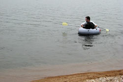
Hikers carrying a small rubber dinghy with them (i.e. the type Alpaca that only weighs 2 kg: ( http://en.wikipedia.org/wiki/Packraft) are on the safe side - be it for transporting the luggage, themselves or others across the river comfortably. A long cord is indispensable in order to get back the dinghy for further crossings. If you don't have a dinghy you should allow for some time, as fi sher or tourist boats pass the spot every now and again, which in most cases help you cross the river. At a pinch two driftwood trunks tied together will do as well. After having crossed the river safely, you follow the path about 500 m along the shore, before a wooden ladder leads you from the shore up to a nice picnic area. The hut there was once built by a private business man without a building license and can be used by everyone today. Unfortunately it has been destroyed a bit, but during bad weather it is still the better choice as opposed to the tent. If you allow for enough time you should use the bay for a day's break, as the sandy beach invites you to take a swim and relax facing a magnifi - cent mountain scenery.
5th day From the Delta of Frolikha River to Ayaya Bay

Down the steps to Lake Baikal, the path leads you along the shore at first, but it gets narrower and is lined by big and partly stacked stone chunks. After about 1,3 km the trail leads you back into the forest. Initially, the incline is steep, but already after a few metres you have a fantastic view from a lump of rock to Frolikha Bay and the river mouth.
The next 600 m you follow the trail through partially dense coniferous and open deciduous forests always above Lake Baikal, before the path leads you steeply downhill towards the wide open shore of the lake again. After a short rest, the next nice leg of the trip leads you to a path above the shore. After about 900 m the track turns left into the taiga again and leads you uphill on a steep path. The incline is quite a long haul and not consolidated in the best possible way, but it off ers you beautiful views over the lake.
Having reached the saddle, a detour towards the west to a fantastic viewpoint about 80 m above the lake is recommendable. When the weather is good, you have a great view to the western banks of the lake with lots of partly over 2000 metre-high peaks. You have to act with caution, however, as the grim is instable and declines very steeply towards the lake. Back at the crossroads you follow the path with a slight decline towards the south back to the shore. After about 2 km you reach a small trigonometric point, to which you should keep in the western direction of the lake. Back at the bank you can either continue on the path above the shore or the one along the wonderful sandy beach. In either case, a short break is just the right thing in order to get some rest or to enjoy a refreshing swim in Lakanda Bay.
After having reached an extremely dry clearing at the beginning of Cape Lakanda, both paths cross each other again at the latest. The trail turns off from the shore now and leads you through the clearing and later through light pine wood via the small headland to Ayaya Bay. About 4,2 km now separate you from the next picnic area. After a few metres the trail leads you to a nice sandy beach again, before you follow the path
to Ayaya Bay through the forest. Apart from some hard climbing sections between kilometre 2,5 and 3,5 you get ahead quickly from here. If you still have some time, it is worth taking a break on one of the cliff s that rise up out of the water. If you are lucky, you can watch Nerpas
(Baikal seals), which like to cavort in this stretch of water.
Shortly after having passed another small ranger hut, the path leads you out of the forest to the shore again. After a few metres another small river has to be crossed. Now the beach of the most popular destination at the northern Baikal begins, the "very, very nice" (which is the translation from the Burjatic language) Ayaya Bay. Between the pines there are countless protected spots where you should always fi nd a place for your tent, even in midsummer
6th day From Ayaya Bay to Lake Frolikha

From Ayaya Bay two trails east and west of the small river lead you onto the mountains to Lake Frolikha. The slowly inclining path is about 5 km long and leads you through partly marshy sections to Lake Frolikha. Having
arrived there you should not be confused or even disappointed, as the path ends at a rather unimpressive, brackish branch of the lake. Only some hundred metres ahead the overwhelming mountain scenery with the crystal clear water of the lake opens up to you.
It is generally worth taking the small rubber dinghy that you needed for crossing the Frolikha river with you for this trip, as the unique beauty of the lake especially opens up to you during a journey along its shore. For everyone who has already enjoyed enough sunsets at Lake Baikal
it is recommendable to spend the night at Lake Frolikha and admire the sunrise above the mountain peaks the next morning before returning to Ayaya Bay.
Lake Frolikha is not only interesting due to its scenic beauty, embedded between high mountains that are covered in snow most of the time. The glacial lake with a size of 16.5 km2 and a depth of up to 80 m is also inhabited by the Davatshan fish, a species which has not changed since the last ice age and can only be seen in a few remote lakes of the Baikal region.
7th day From Ayaya Bay to Tukalaragdy Bay

From Ayaya Bay you follow the path directly along the beach for some hundred metres. Every now and then you have to surmount some cliff s, which are no real obstacles for experienced hikers, though. After crossing a small creek (via a bridge) you turn back into the forest. From here on you follow the trail almost always near the shore with a splendid view over Ayaya Bay. The altogether short sections of this leg lead you on beautiful sandy beaches, which invite you to rest time and again. After about 3 km the path separates. You either turn left and follow the trail eastwards through the forest or you continue walking along the shore of Lake Baikal. Although the alternative that leads you along the shore off ers you magnifi cent views over the lake, it is a technically demanding section. In parts you have to climb over metre-high blocks of stone, between which dangerous crevices open up. Although this section is only
1.5 km long, you should allow for two hours of time. The other alternative leads you on a well consolidated path across a small mountain ridge through the forest back to the shore of the lake in one hour.
Afterwards you continue walking on a sandy beach, parted by a creek with good drinking water quality, for about 50 m, before following the path through the forest, always parallel to the shore. With some luck and a lot of patience this section off ers you the possibility to watch Nerpas at close range again. It is advisable to hide in the forest to not be noticed by the seals. As soon as this happens, the extremely shy animals mostly disappear for a long time!
After 2 km you arrive at Cape Tukalaragdy and shortly afterwards at the correspondent bay with probably the most beautiful campsite of the entire tour. An enormous sandy beach off ers enough space for tents, the water is free of stones and you have a fantastic view over the western
bank. Apart from a fire place there is a covered table and even an outhouse. Lots of fresh bear tracks verify, however, that not only humans appreciate the beauty of this spot. Therefore you should act with caution and especially not go into the forest in the dark alone.
8th day From Tukalaragdy Bay to Khakussy

At "bear beach" only about 8 km separate you from Khakussy. The path does not show any special technical diffi culties. Like during the prior legs you follow the path on a more or less stony beach or through the forest near the shore. The last adventure is the crossing of the eight metrewide, hip-deep river Biraya about 2.5 km ahead of Khakussy. There is no bridge, but as the river has almost no current the crossing should not be a problem. Afterwards, the well stamped out dirt track leads you through the forest to the hot springs in Khakussy.
From here you take the daily run ferry of the health clinic back to Nishneangarsk. It is defi nitely recommendable, however, to stay a few more days in Khakussy, in order to explore the near surroundings and to relax in the hot springs.
Khakussy has its origin in the Evenki language and means "hot spring". In 1775, it was characterised for the first time by Johann Georgi, a German pharmacist who mapped the shores of Lake Baikal for the first time and was appointed to the assistant of the Russian Academy of Science. The springs have a temperature of 42 - 46 °C and are rich in sulphates, sodium compounds, potassium acid as well as nitrogen and are said to have a pleasant effect on the body. For this reason, the health clinic of the Nishneangarsk hospital was opened in 1953 and is still open today.
9th /10th day South of Khakussy

From Khakussy you follow the track further south until you reach the borderline of the Bargusin biosphere reserve. The fi rst 2 km lead you along a beautiful sandy beach again, at which end the trail turns sharply left into the forest. Now you follow a well developed and marked path through the Siberian taiga. After 12 km the forest thins out and south of Cape Turali a paradisiacal bay with a 20 m high sand dune opens up to you. In the Evenki language, Turali means "singing sand", as in the past the dune produced sounds during special winds. Even if the dune does not sing anymore today, the sandy beach still invites you to take a swim. The water here is very shallow and warm in summer. At the south end of the bay is Shirilda Delta. Above the bay there are three small caves that can be explored easily. For the crossing of the river Shirilda you either need a rubber dinghy or you wait for fishermen to take you across. Afterwards, the track leads you always along the shore, but it is not marked anymore. Apart from many wider and narrower rivers that have to be crossed this leg of the trip is relatively easy. After 13 km you reach a manned weather station at Tompuda Bay. Under certain conditions you can trade fi sh and at a pinch spend the night there. Also the Tompuda river can only be crossed by boat. Already after seven kilometres the next river, the Kodakta, fl ows into Lake Baikal, at whose river mouth you fi nd an occasionally inhabited hut. After 8 km you reach the Shegnanda river, which can be crossed at a ford also being used by some Evenki living here again. Apart from reindeer breeding the inhabitants try to resurrect the Evenki tradition and to attract tourists. The settlement borders on the Bargusin biosphere reserve, which must not be entered without special permission. Now you either take the same way back to Khakussy or you get picked up at the Shegnanda river in case you have booked a boat in advance.
You can buy a printed version with lots of deatailed maps at shop.baikalplan.de for 5
GPS Track
Here you can download the Track as gpx-file for your GPS. Download